
All the map data and network elements (sites, cells/BNs, UEs/RNs, etc.) in a single project must fall within the same projection zone. This is because propagation simulations use map data from one projection zone only.
You can learn more about finding the UTM zone for an address on this page: Steps to Find UTM Zone for an Address | Help Center Telecom
Example - The USA
The USA is divided into UTM zones, as shown in the figure below:
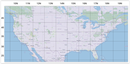
If your address or areas of interest are in UTM zone 10N, the corresponding EPSG projection code is 32610. To find the zone and EPSG code for your own area, see Find UTM Zone.
EPSG 32610 is then selected as the projection zone of the Planner project. All the map data for this projection zone (the blue area in the image below) can be downloaded using GIS select > GIS extract.
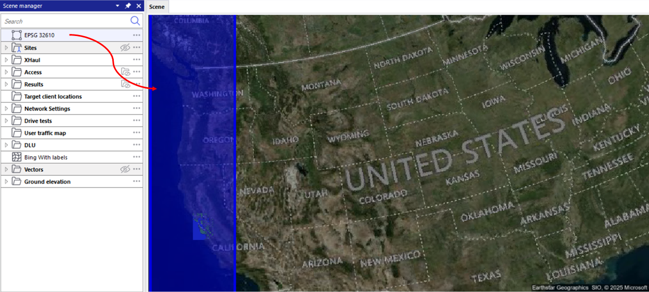
To handle sites near a zone boundary, the map data of each projection zone includes a 40 km buffer beyond its edges. This means any site, even one on the border between two UTM zones, can always be simulated in at least one projection zone.
If you try to download map data beyond this buffer, for example deeper into the adjoining UTM zone 11N (EPSG 32611), you will see this error message:
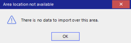
For more details on this message and how to fix it, see Message: There is no data to import over this area.
What to do if your addresses or areas of interest span multiple projection zones
-
Check whether all your sites can fit into one projection zone. Use the Select the Correct Projection in Planner action to see which of your network elements fall into which UTM zone. Thanks to the 40 km buffer included in the map data of each projection zone, sites located near a zone border can usually still be covered by a single zone. If this is the case, select that zone for your project.
Tip: If your project is already set to the zone you want to check, the action will not show you the whole zone. Use the Select the Correct Projection in Planner action on another UTM zone , then switch back to your original zone.
-
If not, divide your project. Split the customer and tower (site) data by projection zone and create one Planner project for each zone.
To ensure reliable simulation results, all the map data in a project should come from its selected projection zone only.